![Item #6591 School Atlas to Cummings' Ancient & Modern Geography [Cover title].](https://langdonmanorbooks.cdn.bibliopolis.com/pictures/6591.jpg?width=768&height=1000&fit=bounds&auto=webp&v=1680291721)
![School Atlas to Cummings' Ancient & Modern Geography [Cover title].](https://langdonmanorbooks.cdn.bibliopolis.com/pictures/6591_2.jpg?auto=webp&v=1680291721)
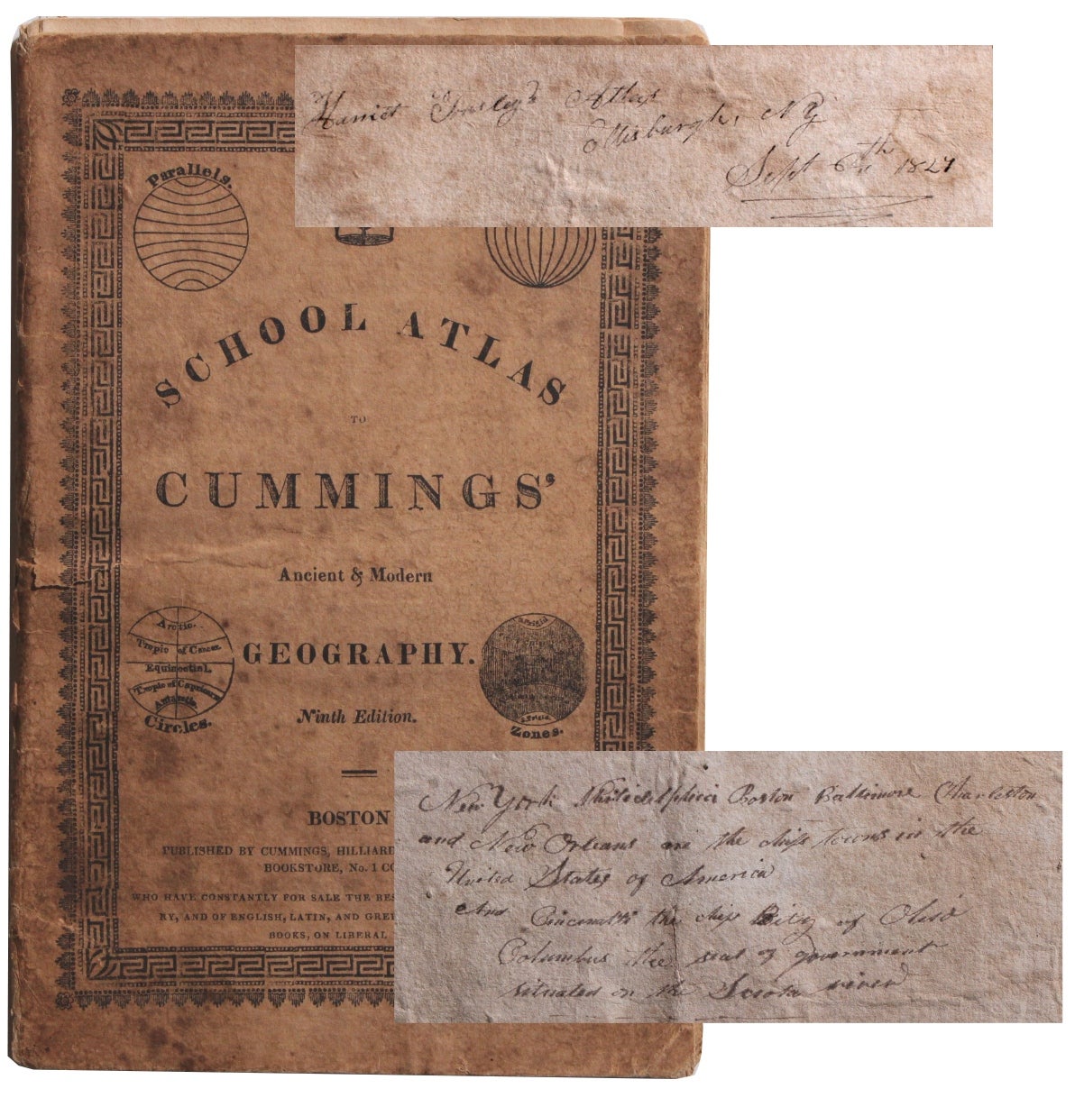
School Atlas to Cummings' Ancient & Modern Geography [Cover title].
Boston: Cummings, Hilliard, & Co., [1823]. Ninth Edition. 9½” x 6¼”. Thin card wrappers. Eight double-page maps hand-colored in outline. Good: wrappers heavily soiled and separated from text block but attached to each other; three maps with chipping to edges, outside map boundaries; map of Europe with a 3” split at fold; light to moderate dust soiling and offsetting throughout.
This is an uncommon book of maps, owned and notated by a Harriet Tousley or Towsley, a woman in her 20s in Ellisburg, New York in the 1820s.
The book consists of eight double-page maps including North America and the United States. It was published to accompany the textbook, Cummings' Ancient and Modern Geography, and Tousley noted in this copy that she had purchased both. Her other notes include a date (September 1827) and a fact: “Mississippi River is the largest in the United States of America.” Tousley also made notes on geography inside the rear wrapper: “New York Philadelphia Boston Baltimore Charleston and New Orleans are the ships towns in the United States of America and Cincinnati the ship city of Ohio – Columbus the seat of government situated on the Scioto river.”
We were unable to discover anything about Tousley beyond that she was born around 1801; we still don't know whether she was a student, a teacher, or teaching herself, but an American woman studying geography at this time period is certainly worthy of further research. Good. Item #6591
Price: $600.00