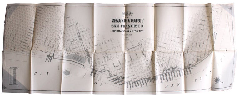
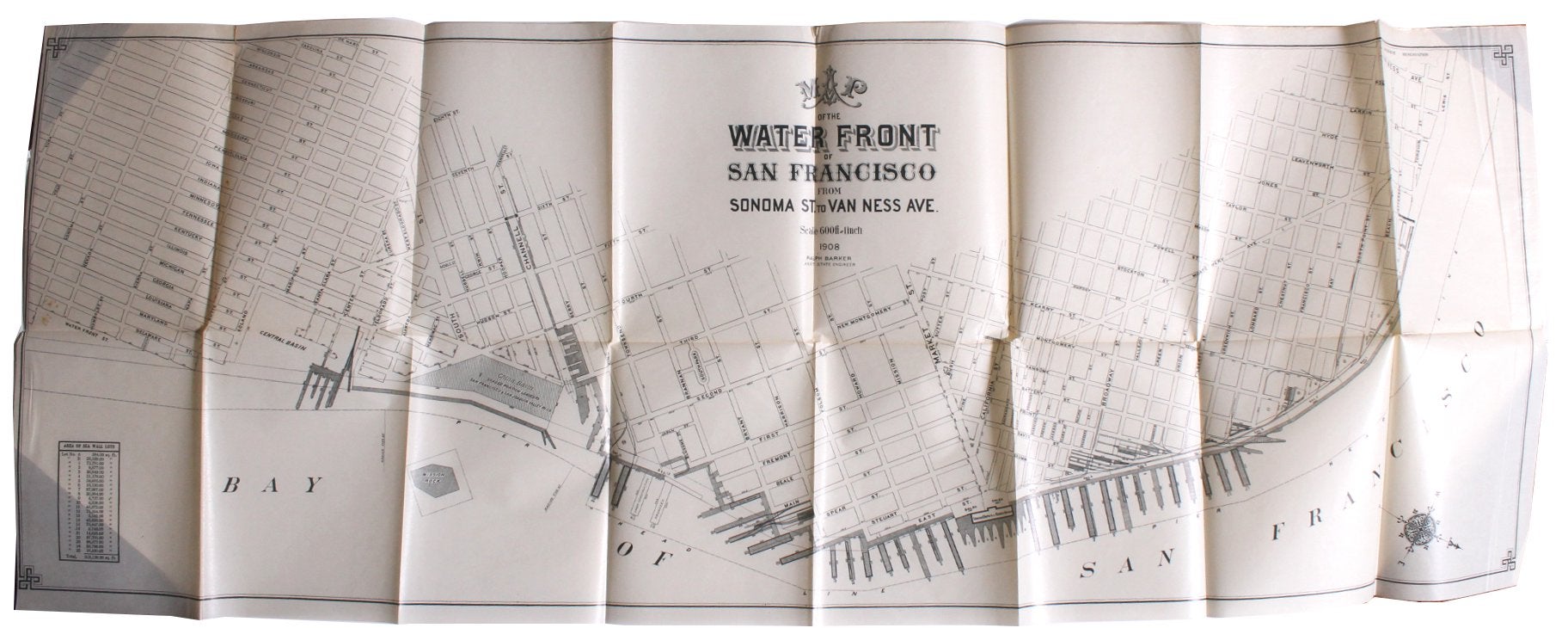
Barker, Ralph. Map of the Waterfront of San Francisco From Sonoma St. to Van Ness Ave.
N.p. N.p., 1908. 15 3/8” x 41¾”. Printed on a coated, waxlike paper. Very good : a couple of tiny separations at intersections, small closed tear at another, 2” vertical separation at far upper left, a couple of small edge chips, some scattered pinpoints of soiling.
A scarce map of San Francisco's waterfront, its southernmost edge shows a portion of Yuba Street and the far Northwest is a portion of Lewis Street. It also denotes the square footage of 27 labeled seawall lots. The map may have been created to assist its maker in evaluating a number of plans for building up the waterfront, as an application the Embarcadero waterfront entered into the National Register of Historic Places shows his regular involvement in those plans from 1908 onward.
We locate only a digital copy at Berkeley. Very good. Item #3468
Price: $750.00