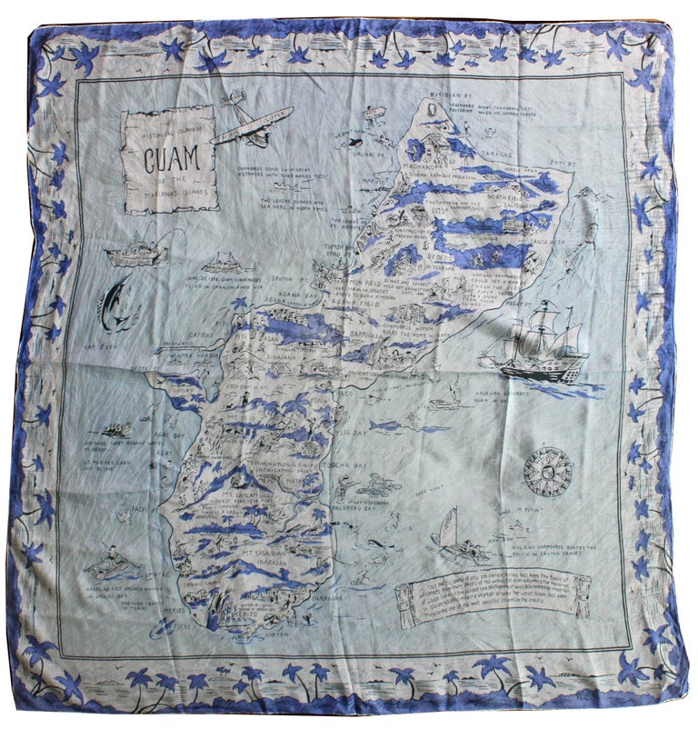
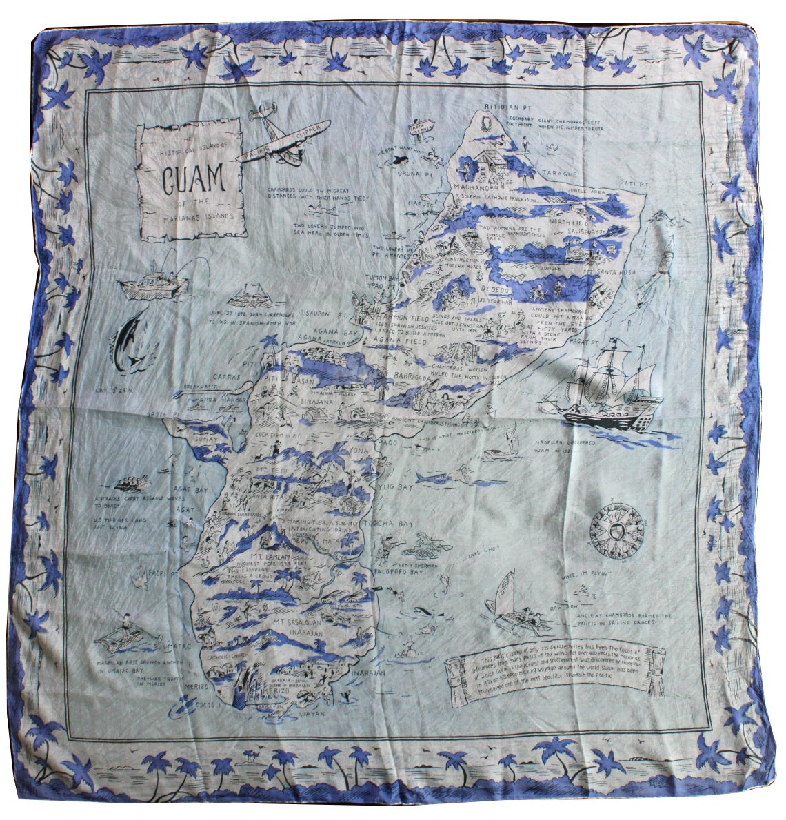
The Historical Island of Guam of the Marianas Islands.
Guam: N.P., [circa 1945-1950s]. 34” x 31½”. Map printed on silk. Very good: numerous light creases and folds; light dust-soiling.
This is an intricately pictorial map of the island of Guam, printed on silk and likely issued as a tourist souvenir, with many narrative depictions of Guamanian history and culture. Along with geographical and topographical aspects such as Mt. Lamlam, Guam's highest peak, jungle and coastal areas, the map also features important dates in Guam's history including Magellan's discovery of the island in 1521, “June 20, 1898, Guam surrenders to the U.S. in Spanish-Amer. war,” and the landing of United States Marines in July 1944. The map portrays images of Guamanian culture both contemporary and historical, including a cockfight in Piti, net fishermen in Talofofo Bay, and the making of “Tuba, a slightly intoxicating drink.” Narratives steeped in fact as well as those of mythology and lore are displayed, such as “Ancient Chomorro could hit a man between the eyes at 50 yards with a stone from their sling,” and “Two lovers jumped into sea here in olden times.” There are cartoon images of houses, churches, people and animals, and one portion simply reads, “We're being invaded again.”
A visually appealing source of Guamanian geography, culture and history. Not found in OCLC, though a Google search revealed a possible holding at Hartwick College in New York. Very good. Item #6593
Price: $600.00